Useful
Entertaining
| Distance | 5km, circular walk, 130 metres up/down each |
|---|---|
| Duration | Approx. 1h walk + time for searching |
| Starting point/ cache | N 47.72039, E 9.06553 / GC5M59K |
| Equipment | Sturdy shoes. Pen for logging. |
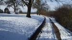
| Trail types | Mainly small paths, partially tarmacked, partially soft paths with risk of mud in wet conditions |
| How to get around | Best on foot. Restricted suitability for bicycles (and stroller). NO ACCESS for motor vehicles! |
| Sun / shade | Sunny, little shade. |
| How to get here | By car, train, bus, bicycle: There are numerous parkings (the ones close to the lake are pay-and-display, the ones closer to the starting point are free). From the train station, the bus stops and the bicycle trail around the lake, you can get to the trail within a few minutes by foot. See map. |
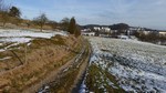
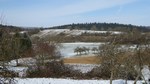
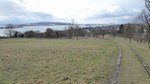
| Surroundings | Meadows and fields. For a short while you walk along the edge of the village and later on through a residential area. |
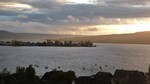
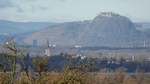
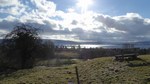
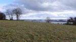
| Views | Lake Constance, Hegau, Switzerland, Alps (depending on the weather) |
| Caches | 16+3 Tradis*: AllensbachHills #01-#15 and GC27GMT. Via a small excursion: GC4KFQN, GC21HK2 und GC4KFRC. |
|---|---|
| Cache size | 15 PETlings, 1 larger box for travelbugs / coins |
| Feedback | The same entry for all caches is welcome, especially if they are a bit more elaborate and if you evaluate the tour also on this website! |
| Terrain / difficulty | All caches are easy to reach (cp. trail type). Finding the cache without the hints may not be too easy in some cases, but should be no problem with the hint. |
| Camouflage | Hidden within smaller or larger constructions. |
| Seasonal restrictions | The geocaches are available all year. Many of them are completely snow-safe, and nearly all of them can still be found as long as the cover of snow is not too thick. |
| Risk of mugglers | High - please be careful! |
| Distance between caches | On average approx. 300m |
| Equipment | Pen for logging. No special tools required. |
| Owner | cenact |
| Available since | February 2015 |
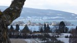
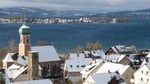
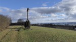
View from the Fohrenbühl:
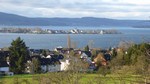
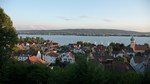
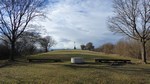
View from the Walzenberg:
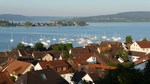
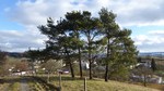
View from theHöhrenberg:
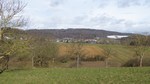
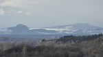
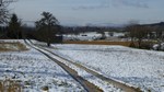
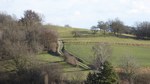
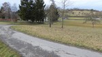
View to the Hegau:
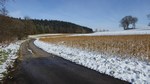
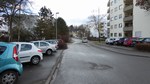
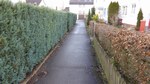
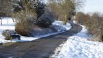
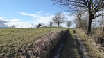
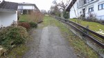
Along the edge of the village:
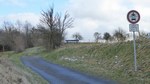
At the Nägelried:
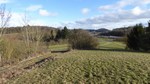
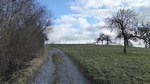
On the Fohrenbühl:
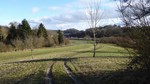
On the Walzenberg:
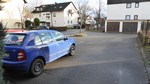
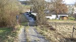
Crossing the residential area:
On the Höhrenberg:
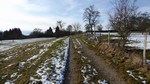
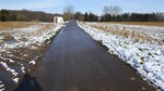
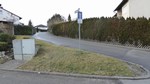
From the starting point to the Nägelried:
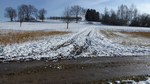
Up and down the Fohrenbühl:
Up and down the Walzenberg:
Up and down the Höhrenberg:

You follow this trail at your own risk! (see disclaimer)!
| Cache | Coordinates | GC-Code (linked with geocaching.com) |
|---|---|---|
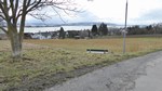
| #1 - Playgrounds | N 47° 43.179 E° 009 04.046 | GC5M59K |
| #2 - Village View | N 47° 43.281 E° 009 03.883 | GC5M59M |
| #3 - Sonnenhöhe | N 47° 43.266 E 009° 03.677 | GC5M1JR |
| #4 - Hazelnut | N 47° 43.314 E 009° 03.462 | GC5M596 |
| #5 - Fir | N 47° 43.326 E 009° 03.270 | GC5M597 |
| #6 - Ivy | N 47° 43.461 E 009° 03.219 | GC5M598 |
| #7 - Nägelried | N 47° 43.626 E 009° 03.283 | GC5M59A |
| #8 - Fohrenbühl | N 47° 43.587 E 009° 03.414 | GC5KPVH |
| (Annabelle's Cache) | N 47° 43.559 E 009° 03.537 | GC27GMT |
| #9 - Hedgerow | N 47° 43.527 E 009° 03.661 | GC5M59B |
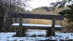
| #10 - Bench | N 47° 43.431 E 009° 03.731 | GC5M59C |
| #11 - Squirrel | N 47° 43.378 E 009° 03.856 | GC5M59D |
| #12 - Walzenberg | N 47° 43.333 E 009° 03.990 | GC5J4J6 |
| #13 - Warm Light | N 47° 43.301 E 009° 04.140 | GC5M59E |
| (Weg nach Allensbach#12) | N 47° 43.240 E 009° 04.343 | GC4KFQN |
| #14 - Energized | N 47° 43.174 E 009° 04.219 | GC5M59H |
| #15 - Höhrenberg | N 47° 43.087 E 009° 04.213 | GC5J0TA |
Two mystery-/multi-trails created by us take you along the lake and through the centre of Allensbach:
cQuiz AllensbachLakeside (GC5TTE0) and
cMem AllensbachLakeside (GC5TTF0)
Further geocaching trails - easier to find with evaluation, trail and cache infos on a specialised map: www.cenact.de.